
Mobile Mapping System V100
The lightest in the class |  | Collected per Second | | |
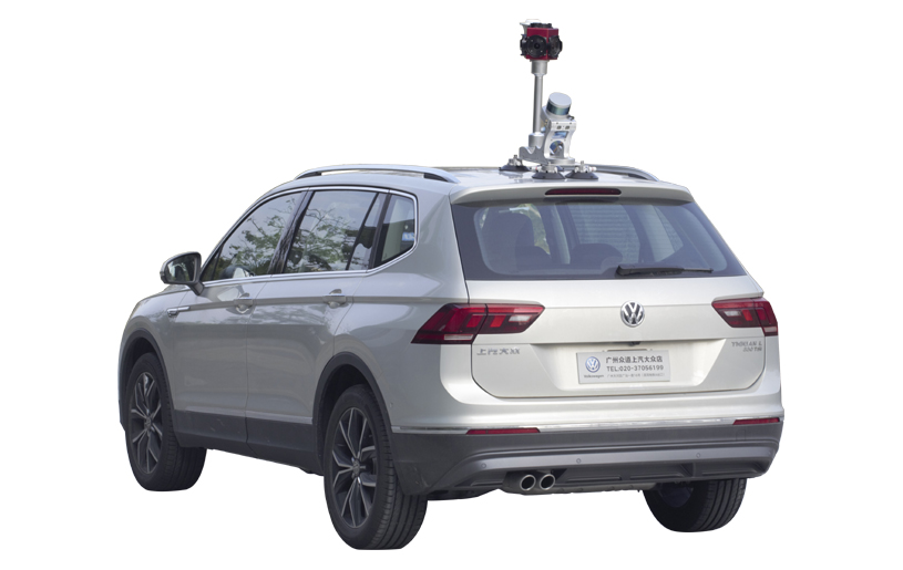
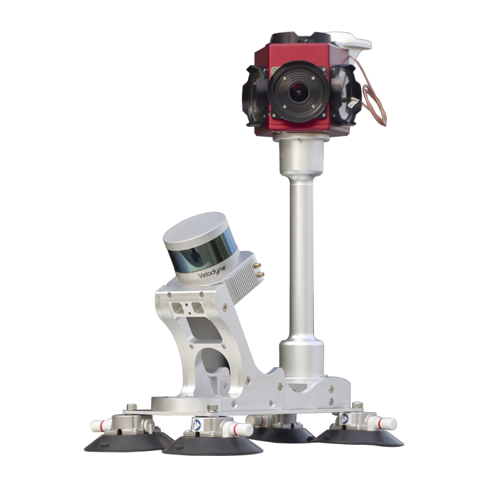
| Smaller and Lighter Easy to Handle V100 is the most compact and lightweight mobile mapping system in the market. The mainbody of V100 weighs only 1.5kg (without camera), it is easy to carry, easy to install, easy to maintain. |
Longstanding Experience Builds Up Reliability With over 500,000 kilometers road data collected in the past 5 years, Kolida mobile mapping system has proven itself as a practical and reliable solution for 3D data and panoramic imagery acquisition. |  |
| Mass Data Acquisition in Short Time V100 system consists of a Velodyne VLP-16 LiDAR sensor, a dual-frequency GNSS Positioning and Orientating System, a 30-Megapixel panoramic camera, a Inertial Measurement Unit, and a central control unit. It can collect 300,000 points per second at a range of 100m, with minimized scanning shade. When compared with traditional ground surveying, using V100 mobile mapping system, the data collection in the field will be 5 to 10 times faster, the overall job time is 2 to 6 times faster, the cost will reduced for more than 40%. |
Money-Saving The system can be used in measuring roadway, railway, waterway, skyway. Its designing principle is to work for complex mission environment. So user can avoid overlapping investment and the wasting of capital. |  |
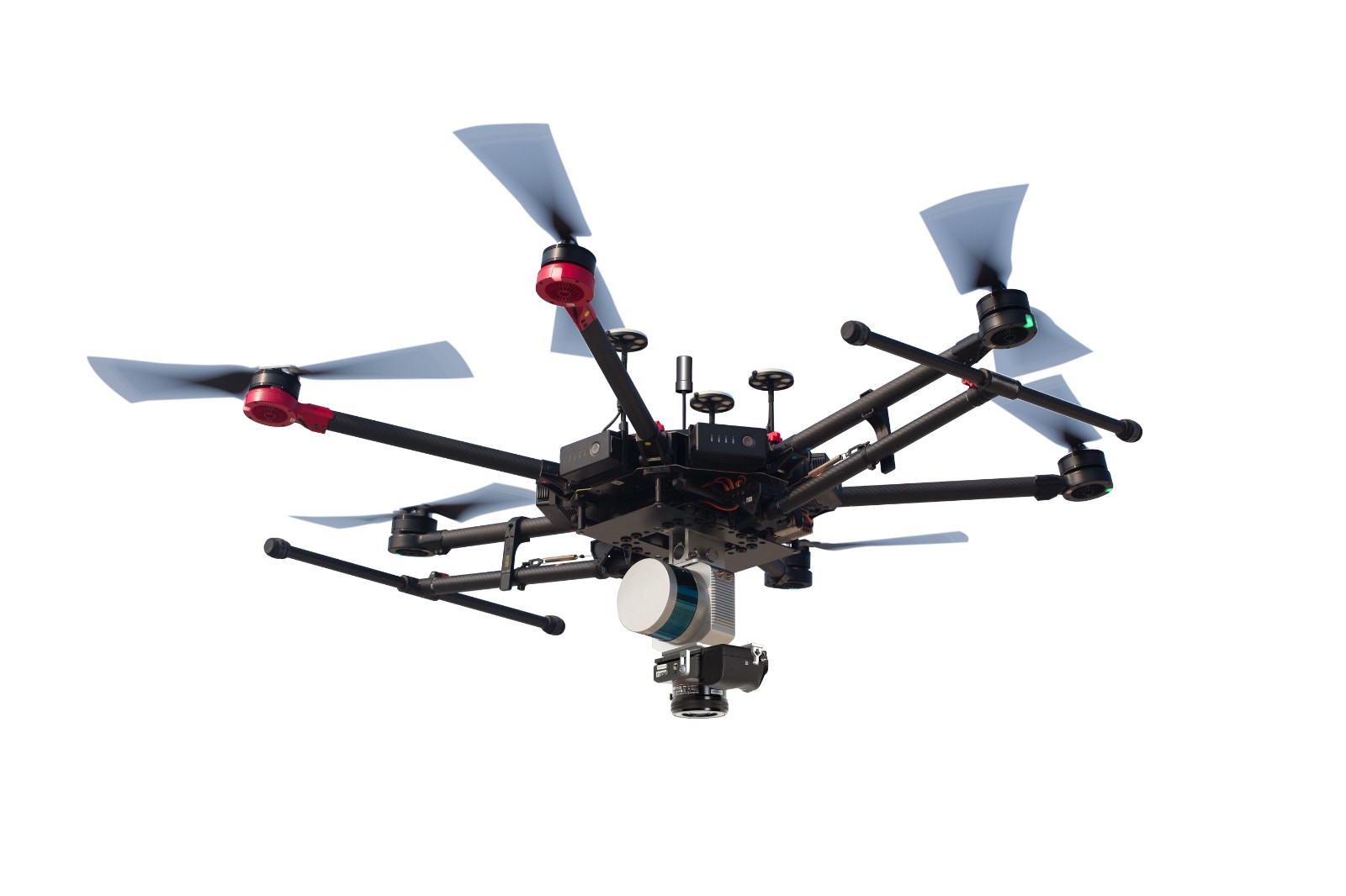
| Work Where Others Can't V100 not only can be mounted onto a ground vehicle but also can be deployed onto a multi-rotor UAV, to measure the object or place that ground measurement system can't measure. For instance, the top of building, electrical tower, transmission line, roadside houses, underneath space of elevated road and bridge, primeval forest. |
Maximize the Utilization of Data KOLIDA Z-Lab Data Processing Suite can classify and process geo-reference data, point cloud, image, then export extracted information into GIS and CAD deliverables. Data in standard file formats allows users to easily plug it into their existing workflows and business processes. One time measurement, many times benefit. |  |
A case study of road survey: http://www.kolidainstrument.com/news/details/id/78.html

Watch Video from youtube.com: https://youtu.be/pEiXd-_vGm8
| Laser Scanner | ||
TypeMulti-beam rotating LiDAR | Channels16 | Data Rate300,000 points/ second |
| Measuring Range100m | Accuracytypically ±3cm | |
| Camera (for SUV) | ||
Number of Cameras6 | Camera ModelFLIR Ladybug5+ | Resolution2048 x 2448 |
| Field of View 90% of full sphere | Maximum Frame Rate 30 FPS JPEG Compressed; 14.5 FPS Uncompressed | |
| Global Positioning | ||
GNSS TypeGNSS receiver, GPS, GLONASS, SBAS. | GNSS AntennaDual Frequency | Post-processing AccuracyH 5mm, V10mm |
| Gyroscope Performance Bias in-run Stability 1deg/hr | Accelerometer Performance measurement range ±8g | |
| Operation Specification | ||
Operation Temperature-10℃ to 60℃ | Storage Temperature -40℃ to 105℃ | IP Protection LevelIP67 |
See more specs
5861
Mini LiDAR System SZT-V100.pdf
PDF [381.834KB] download
KOLIDA Instrument (KOLIDA) is a leading manufacturer of precision surveying equipment.
COMPANY PROFILE

