English[Change]
LIDAR UAV
GNSS SYSTEM
TOTAL STATION
THEODOLITE LEVEL
TOOLS ACCESSORIES
ABOUT US
NEWS
VIDEO
CONTACT US
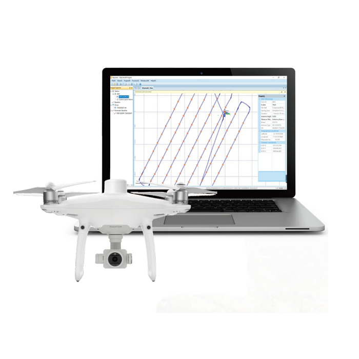
SkyLines is engineered to deal with the flight lines and compute precise aerial positional information of drones.