English[Change]
LIDAR UAV
GNSS SYSTEM
TOTAL STATION
THEODOLITE LEVEL
TOOLS ACCESSORIES
ABOUT US
NEWS
VIDEO
CONTACT US
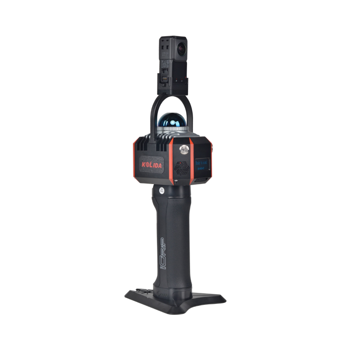
K100 provides real-time point clouds,color point clouds, brings you efficient, accurate and convenient user experience.
The fusion of SLAM positioning and Laser Scanning, fit for various indoor/ outdoor high precision mapping projects.