
2cm/ 60° Tilt , (Optional) |  | All Constellation Signal Tracking | | | Hot-swappable & Extra Power Source |
 | More Advanced GNSS Engine In the second half of 2021, K5 UFO has been updated with a powerful 965 channels GNSS mainboard. With the utility of BEIDOU (COMPASS) B3 signal, the data acquisition speed and GNSS signal stability has been greatly improved from the last version. |
Work safer and easier Thanks to the inertial measurement technology, K5 UFO IMU allows user to do a tilt survey with a maximum tilt angle of 60 °. Centering is not a must, so surveyors can stay in safe position when they measure on motorway, and don't need to step into water . |  |
 | Fast and accurate Not like tilt sensor, Inertial Measurement Unit is no more affected by the earth's magnetic field and requires no correction. It can be activated and start working within only few seconds, this fast positioning will increase measurement speed by over 20%. The combination algorithm of IMU + GNSS can get fixed solution faster and keep measurement results more stable, accuracy is down to 2cm. Video: https://www.youtube.com/watch?v=BK4v0KHTmNc |
Measure where others can't Corner of wall? Points underneath pipe? Points occupied by car? These targets are no more accessible.. |  |
| Long Range Radio Link SDL400 built-in radio can send signal as far as 7 km in urban area, 8 km in suburban. The maximum coverage is up to 200 sq.km, suitable to have multiple rovers work simultaneously. Video: https://youtu.be/HvJuC9gaFk8 |
Barrier-Free Measurement In difficult environment you may lost connection with base station or VRS network. Don't be disappointed, you can choose from 3 creative work modes to continue surveying without interruption. (Repeater/ Router/ Mobile Refenrence Station) |  |
 | Anti-interference SDL400 built-in radio features anti-interference capability, so K5 IMU can work close to power plant, transformer substation, mobile signal tower and other interference source. |
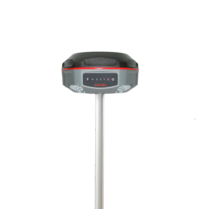
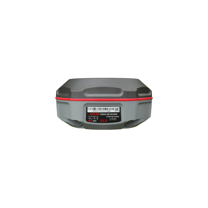
Practical Functions K5 IMU employs Linux system, it helps surveyors to accomplish their missions easier, faster and more accurate by delivering exceptional quality and innovative features. |  |
|
|
New app. New Productivity Windows CE data controller is too old technology? No problem. Simply download SurvX App on your smart phone or tablet. Enjoy the smooth operation of Android platform ! | Post-processing Sw. Free of Charge KOLIDA GEO Office integrates static data processing & Kinematic data adjustment |
| Video Demonstration: https://www.linkedin.com/pulse/inertial-measurement-rtk-k5-imu-bring-your-productivity-andy-lau | |
| Satellite Tracking Ability | ||
Channels965 (upgraded in August 2021) | ConstellationGPS, GLONASS, BEIDOU, GALILEO, SBAS, QZSS | MSS L-BandFunction preserved |
| Positioning Output Rate1Hz-50Hz | Initialization Time<10s | |
| Positioning Precision | ||
Post-processing kinematic (PPK)Horizontal ±8mm + 1 ppmVertical ±15mm + 1ppm | RTK and Network RTKHorizontal ±8mm + 0.5ppmVertical ±15mm+0.5ppm | RTXHorizontal ±2cmVertical ±5cm |
| Static and Fast Static Horizontal ±2.5mm + 0.5ppmVertical ±5mm + 0.5ppm | RTK Initialization Time 2-8s | |
| User Interaction | ||
Operation SystemLinux | Web UIYes | WifiYes |
| Voice Guide Yes | Data Storage 8GB internal; up to 32GB external. | |
| Working Capability | ||
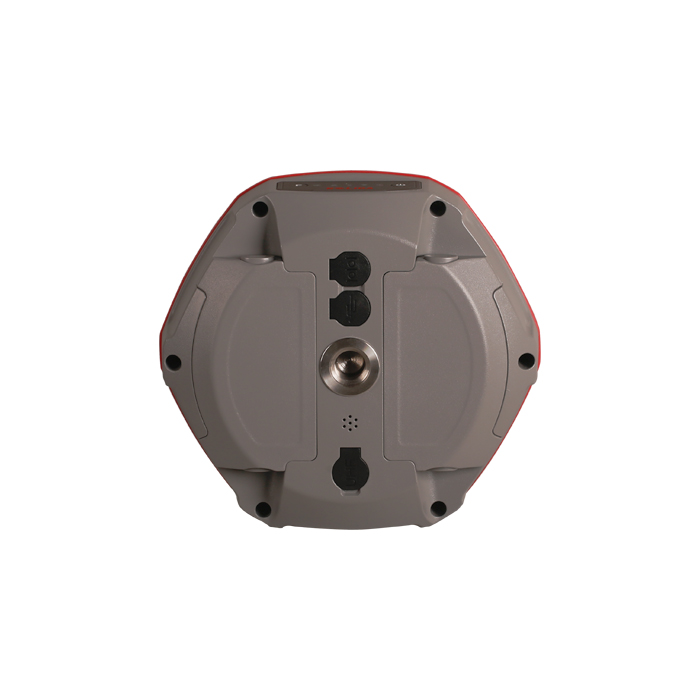
RadioBuilt-in emitting and receivingTypical working range 1-8km | Tilt Survey IMU Sensor is available with K5 UFO IMU | Electronic BubbleYes |
| Endurance >14 hours (static mode), >10 hours (internal UHF base mode), >12 hours (rover mode) | OTG Function (Field Download) yes | Other Function Mobile Reference Station, Repeater, Router, CSD |
| Satellite Tracking Ability | ||
Channels965 (upgraded in August 2021) | ConstellationGPS, GLONASS, BEIDOU, GALILEO, SBAS, QZSS | MSS L-BandFunction preserved |
| Positioning Output Rate1Hz-50Hz | Initialization Time<10s | |
| Positioning Precision | ||
Post-processing kinematic (PPK)Horizontal ±8mm + 1 ppmVertical ±15mm + 1ppm | RTK and Network RTKHorizontal ±8mm + 0.5ppmVertical ±15mm+0.5ppm | RTXHorizontal ±2cmVertical ±5cm |
| Static and Fast Static Horizontal ±2.5mm + 0.5ppmVertical ±5mm + 0.5ppm | RTK Initialization Time 2-8s | |
| User Interaction | ||
Operation SystemLinux | Web UIYes | WifiYes |
| Voice Guide Yes | Data Storage 8GB internal; up to 32GB external. | |
| Working Capability | ||
RadioBuilt-in emitting and receivingTypical working range 1-8km | Tilt Survey IMU Sensor is available with K5 UFO IMU | Electronic BubbleYes |
| Endurance >14 hours (static mode), >10 hours (internal UHF base mode), >12 hours (rover mode) | OTG Function (Field Download) yes | Other Function Mobile Reference Station, Repeater, Router, CSD |
See more specs
11432
k5 ufo (2021.9.9).pdf
PDF [1.642MB] downloadK5IMU EN 200423.pdf
PDF [987.091KB] downloadK5IMU ES 200423.pdf
PDF [987.906KB] download
KOLIDA Instrument (KOLIDA) is a leading manufacturer of precision surveying equipment.
COMPANY PROFILE

