


Surveying, BIM, forestry, stockpile, underground mapping, and more |  | Under High-rise, bridges, in tunnel,garage, excavation,hazardous area | | | Inbuilt Battery + Hot-Swappable Battery Ensures 3-24 hours runtime |
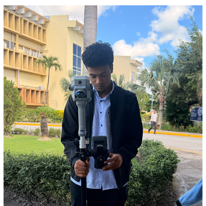
 | Integrates SLAM and RTK, Improving Your Capability When combing the power of GNSS RTK Positioning and SLAM LiDAR Scanning, surveyors can work in both outdoor and indoor environments, performing both contact and non-contact measurements, to tackle tasks they couldn’t previously accomplish. Video: https://www.youtube.com/watch?v=OBUa5miGnYE&t=1s |
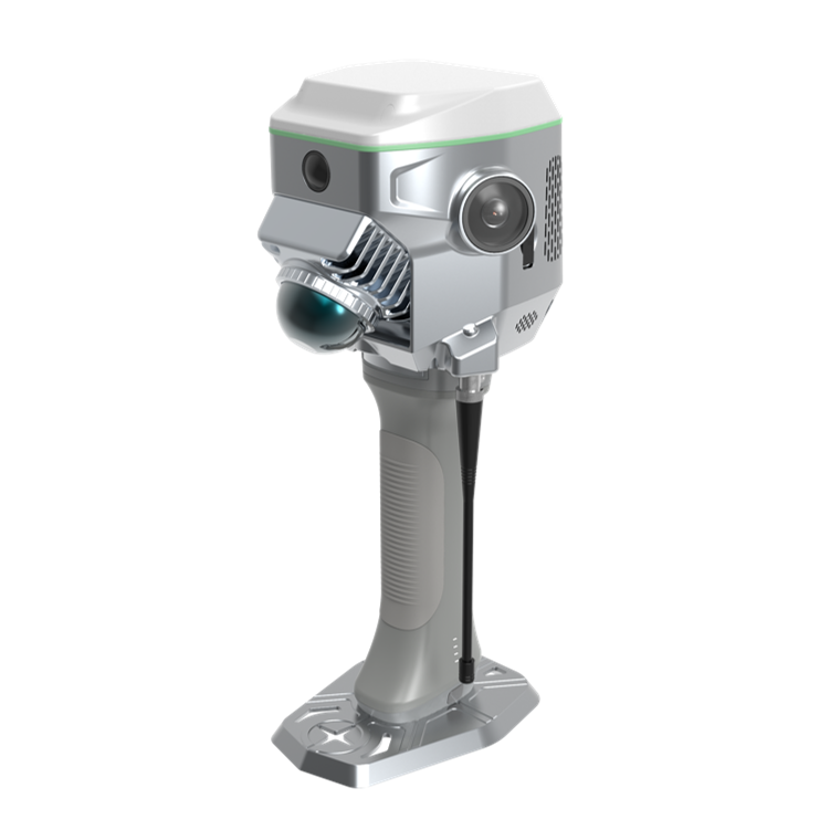
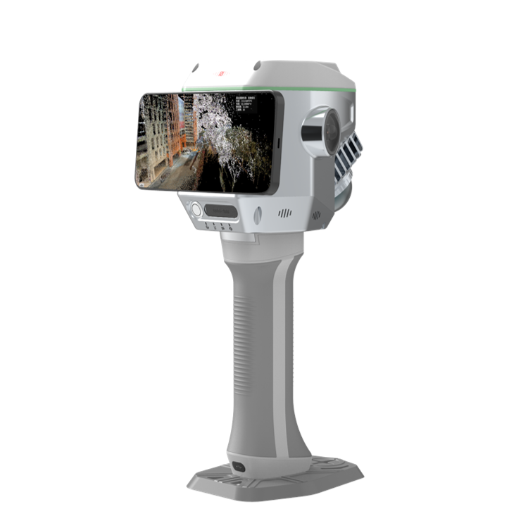
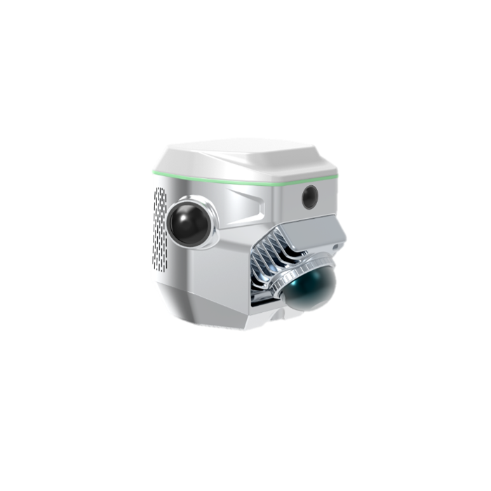
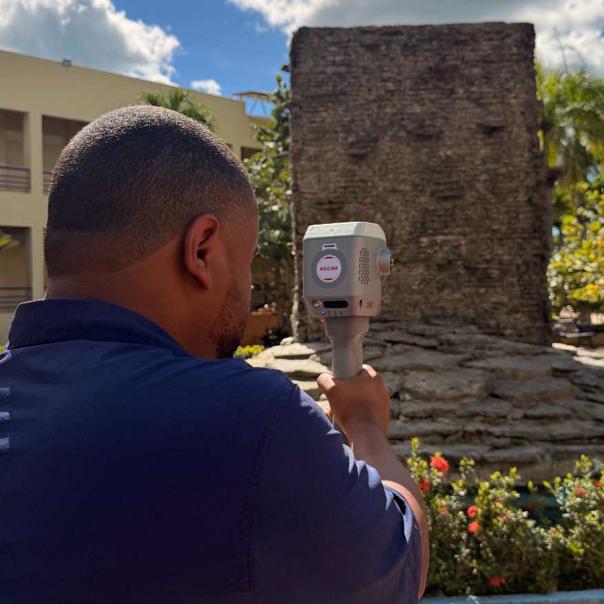
Top Class Hardware, for Image Capture & Processing Equipped with a professional graphic card by Nvidia and dual 12 MP panoramic cameras by SONY, ME is able to ealistically restore scenes. The 8 MP front camera and 2 MP downward camera help surveyor to preform photogrammetry measurement and CAD-AR stakeout efficiently. | click photo to watch video |
 | Capture A Lot of Points, Contactlessly and Easily The Air. Meas. function combines laser sensing technology and AI image matching engine, enables users to collect multiple 3D coordinates by capturing a photo once. Measuring range can be as far as maximum 15 meters, while the accuracy remains 5 cm. This data collection method is a ideal solution for many complex environments for example hard-to-reach areas and hazardous areas. Video: https://www.youtube.com/watch?v=1UPGa2NBrxU |
Magicalc, Positioning Anywhere. ME system is capable to maintain 5 cm accuracy for a few minutes when GNSS satellite signals are out-of-reach, the solution status will change from "fixed" to "Mixed Solution". This innovative function enables users to seamlessly capture data in areas with limited GNSS signals, such as under overpasses, in tunnels, or in underground garages. |  |
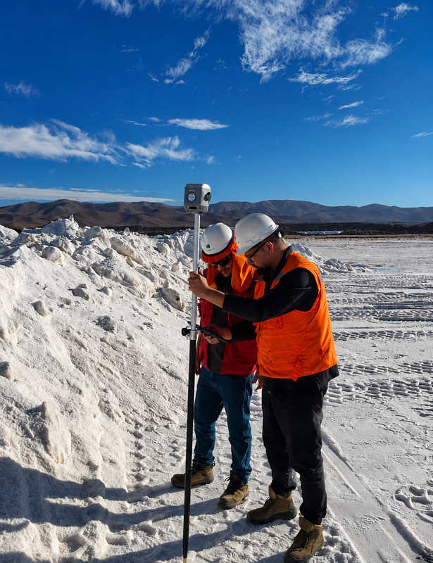
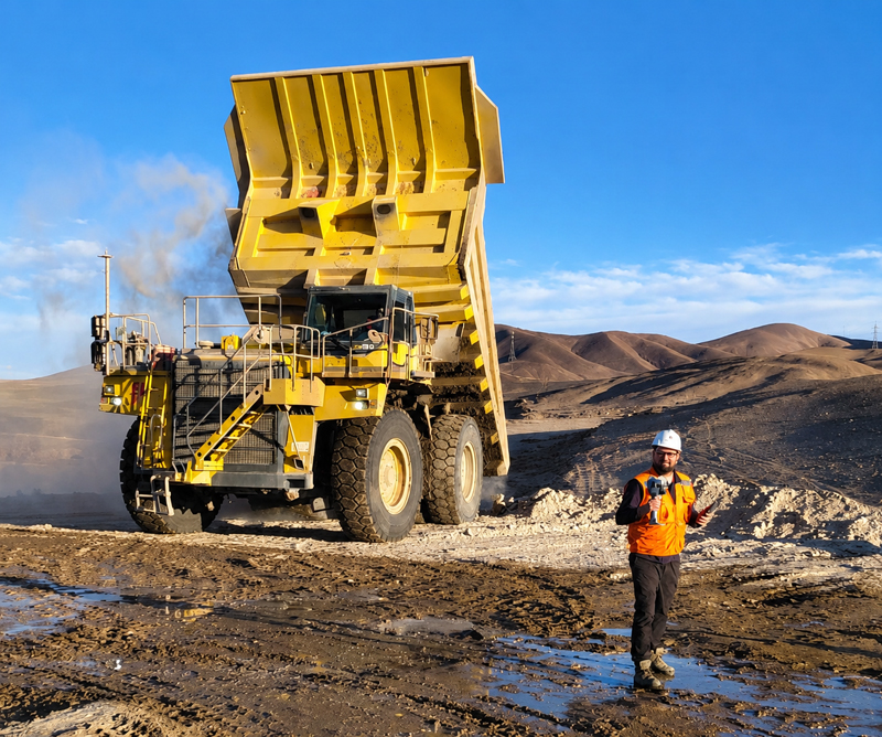
 | Accurate Earthwork Volume Calculation The ME system allows users to perform earthwork calculations by capturing 3D point clouds. The simple and streamlined workflow is very pratical and efficient for excavation, stockpile measurement, mining, constructions. Video: https://www.youtube.com/watch?v=1BX49lLokvk |
Real-time SLAM Mapping, No Need of Loop Closure. The ME features real-time SLAM, creating georeferenced, true-color point clouds directly on-site. This provides instant feedback on collected data, enabling real-time adjustments to ensure comprehensive coverage and reduce the risk of rework. RTK real-time calibration eliminates the need for loop closure, allowing users to freely plan acquisition routes and significantly improve field efficiency. It greatly saves the field working time in large, complex scenarios. | click photo to watch video |
| Satellite Tracking Ability | ||
Channels1698 channels | Constellation GPS, GLONASS, BEIDOU, GALILEO, QZSS, SBAS | L-BandBDS PPP & Galileo HAS |
| Positioning Output Rate1-20 HZ | Initialization Time2-8 s | |
| Positioning Precision | ||
UHF RTKHorizontal ±8mm +1 ppm | Network RTKHorizontal ±8mm +0.5 ppm Vertical ±15mm +0.5 ppm | Static and Fast-Static Horizontal ±2.5mm +0.5 ppm |
| Contactless Measurement 5cm@ 15m range | Positioning without GNSS Signal 3-5cm @20m radius | |
| Hardware Configuration | ||
LiDAR ScannerMaximum scanning range 70m, Speed 200,000 pts/ second | Camera for Colorization12 MP x 2 units, left and right | Camera for Visual-LiDAR Survey & Stakeout8MP in the front and 2 MP at the bottom |
| Battery 1 unit of inbuilt battery & 1 unit of handgrip battery | Data Storage64 GB internal | Communication 1x SIM card Slot1x Inbuilt Radio Receiver |
| Working Capability | ||
| LiDAR ScanningShooting Laser to measure coordinate | Visual PositioningShooting photo or video to measure coordinate | 3D ModelingProcess by Post-processing software |
Visual Stakeout with ARUses Dual-Camera to stakeout pts, lines, CAD | Volume Calculation efficient for excavation, stockpile measurement, mining, constructions. | Tilt Survey Inertial Measurement |
| Endurance up to 25 hours (static mode), up to 24 hours (rover mode), up to 3 hours (LiDAR Scanner mode) | OTG (Field Download) yes | Electronic Bubble Yes |
See more specs
4041

KOLIDA Instrument (KOLIDA) is a leading manufacturer of precision surveying equipment.
COMPANY PROFILE
