
All Constellation Signal Tracking |  | and Electronic Bubble | | | Built-in UHF Transceiving Radio |
 | 555 Channels, All Constellation The advanced 555 channels GNSS board gives K10 excellent signal tracking ability and interference resistant capacity, ensures the fastest and efficient operation under complex environment and terrain. |
Tilt Correction Now it is possible to directly measure a corner or edge of a object. By the virtue of built-in tilt sensor, receiver can correct the measuring result according to tilt angle and direction. |  |
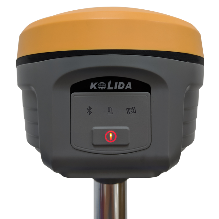
 | E-Bubble Electronic bubble function is designed to help surveyors to make centering easier and faster, while measuring a point, no need to observe physical bubble any more but controller screen. |
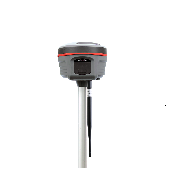
Smart and Handy • Only 1kg weight, less pain to surveyor. • Mechanical Structure, Durable • Packsack style carrying case |  |
 | Suitable for All Kinds of Jobs • One receiver, several application • Compatibility to other brands' radio • Ideal for construction survey |
User Friendly • Voice guide, less time, less mistakes • Simplified keyboard operation • Android APP and WinCE APP optional |  |
 | Quality Excellence • The first mini type GNSS in China • Top-selling model in China and a few countries |
| Satellite Tracking Ability | ||
Channels555 | ConstellationGPS, GLONASS, BEIDOU, GALILEO, SBAS | MSS L-BandN/A |
| Positioning Output Rate1Hz-50Hz | Initialization Time<10s | |
| Positioning Precision | ||
UHF RTKHorizontal ±8mm + 1 ppmVertical ±15mm + 1ppm | Network RTKHorizontal ±8mm + 0.5ppmVertical ±15mm+0.5ppm | RTXN/A |
| Static and Fast Static Horizontal ±2.5mm + 0.5ppmVertical ±3.5mm + 0.4ppm | RTK Initialization Time 2-8s | |
| User Interaction | ||
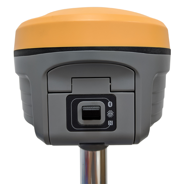
Operation SystemDOS | Web UIN/A | WifiN/A |
| Voice Guide Yes | Data Storage 4GB internal; | |
| Working Capability | ||
RadioBuilt-in emitting and receivingTypical working range 1-5km | Tilt Survey YES, 30° | Electronic BubbleYES |
| Endurance 14 hours (static mode), 10 hours (internal UHF base mode), 12 hours (rover mode) by two batteries | OTG Function (Field Download) N/A | Other Function N/A |
| Satellite Tracking Ability | ||
Channels555 | ConstellationGPS, GLONASS, BEIDOU, GALILEO, SBAS | MSS L-BandN/A |
| Positioning Output Rate1Hz-50Hz | Initialization Time<10s | |
| Positioning Precision | ||
UHF RTKHorizontal ±8mm + 1 ppmVertical ±15mm + 1ppm | Network RTKHorizontal ±8mm + 0.5ppmVertical ±15mm+0.5ppm | RTXN/A |
| Static and Fast Static Horizontal ±2.5mm + 0.5ppmVertical ±3.5mm + 0.4ppm | RTK Initialization Time 2-8s | |
| User Interaction | ||
Operation SystemDOS | Web UIN/A | WifiN/A |
| Voice Guide Yes | Data Storage 4GB internal; | |
| Working Capability | ||
RadioBuilt-in emitting and receivingTypical working range 1-5km | Tilt Survey YES, 30° | Electronic BubbleYES |
| Endurance 14 hours (static mode), 10 hours (internal UHF base mode), 12 hours (rover mode) by two batteries | OTG Function (Field Download) N/A | Other Function N/A |
See more specs
4923
K10 brochure 20190905.pdf
PDF [2.743MB] download
KOLIDA Instrument (KOLIDA) is a leading manufacturer of precision surveying equipment.
COMPANY PROFILE