
Positioning & Stakeout & 3D Modeling |  | Palm-sized RTK | | | Enhanced Positioning Capability |
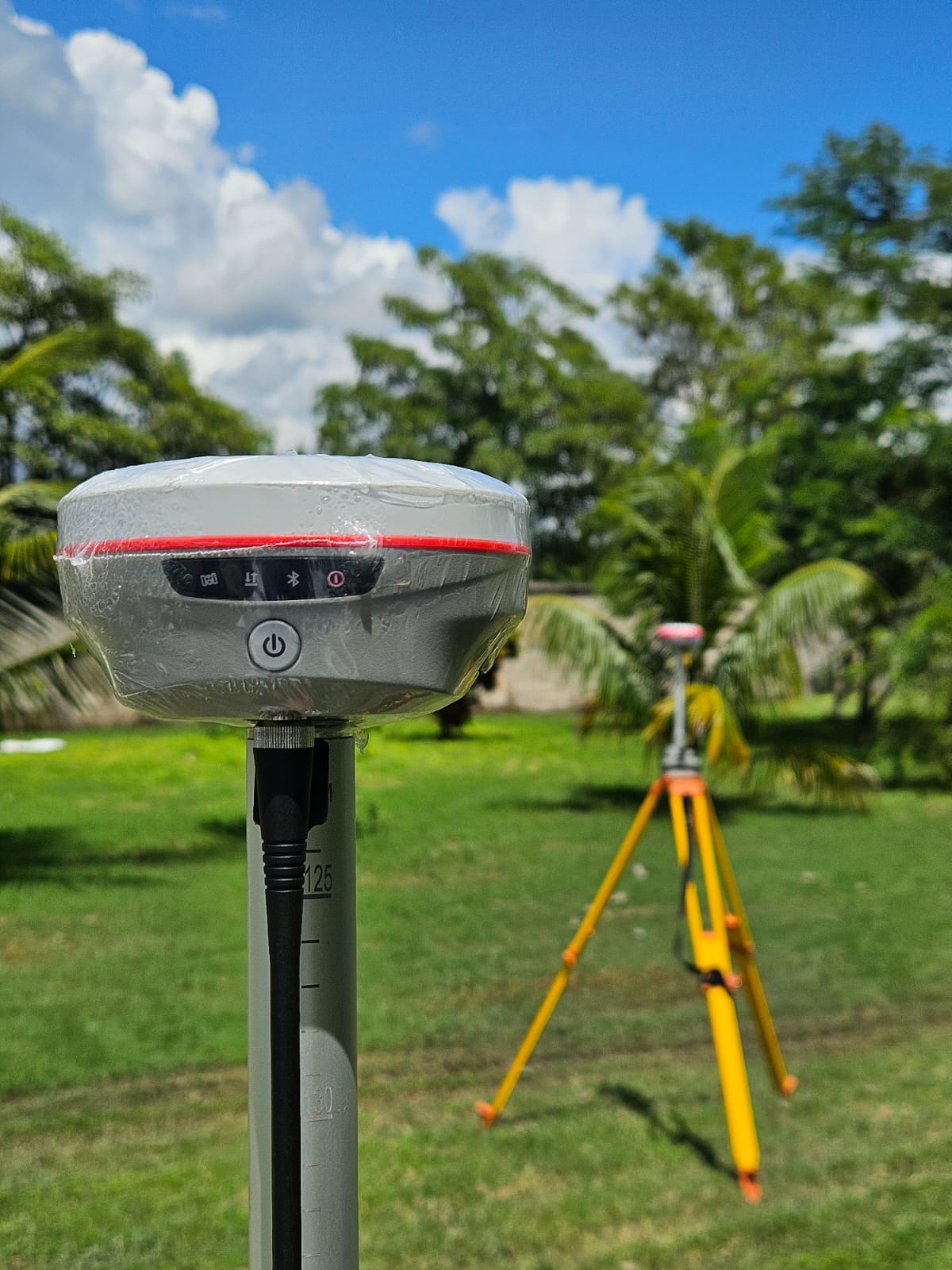
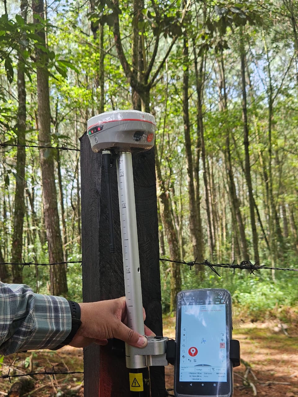
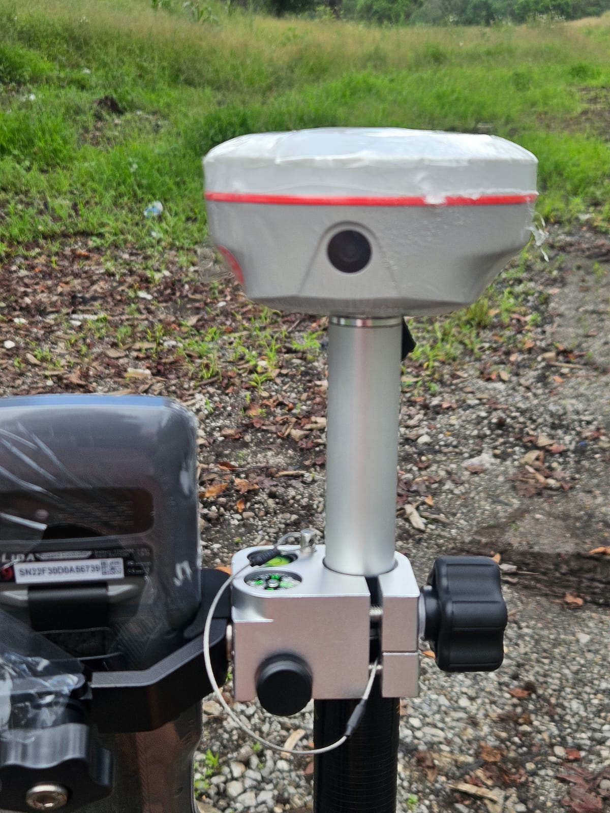
Pocket Sized RTK, Easy to carry and All-terrain surveying. We can put K6X in our pocket due to its 540g weight and 105mm*58mm size , making it portable for surveying and mapping project. With a 650g, extensible from 70-180cm Telescopic pole, K6X becomes more convenient in RTK, PPK Survey, suitable for different measurement environment. | |
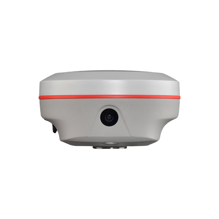
Dual Camera AR Stakeout, Intutive and Precise. K6X allows you to use both of front camera and bottom camera to stakeout points, lines, curves. The AR guideline on controller app will indicate you to go to the correct direction since you are tens of meters away from the target. | |
Visual Positioning (Optional), Eficient,Less-blind spot,Safe. With the optional photogrammetry feature, users can use the K6X to perform non-contact measurement, processing a group of photos or a video in realtime, obtaining coordinates for hundreds of points within minutes. | |
The New 5th Gen.IMU, Simpler and Easier-to-Use. In the past, surveyors would rotate the pole when changing the direction of travel or adjusting the attitude of the receiver, sometimes it disables IMU. Now the 5th generation IMU eliminates the loss of IMU Status in most scenarios to improve the availability and productivity of IMU. The calibrate-free feature save the time of manually initializing IMU each time. | |
Ksurvey App, Increase Your Output. Ksurvey App features a series of practical and unique functionalities: Measure & Draw, CAD Drawing, Visual Positioning, CAD Stakeout, Area Division... Ksurvey also enable users to work it with Kolida total stations. |
| Satellite Tracking Ability | ||
Channels1698 channels | Constellation GPS, GLONASS, BEIDOU, GALILEO, QZSS, SBAS | L-BandGalileo HAS and BDS PPP |
| Positioning Output Rate1-20 HZ | Initialization Time2-8 s | |
| Positioning Precision | ||
UHF RTKHorizontal ±8mm +1 ppm | Network RTKHorizontal ±8mm +0.5 ppm Vertical ±15mm +0.5 ppm | |
| Static and Fast-Static Horizontal ±2.5mm +0.5 ppm | RTK Initial time 2-8s | |
| User Interaction | ||
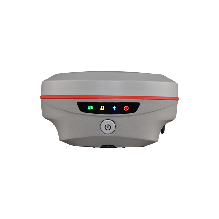
Operation SystemLinux | Screen DisplayNot Available | wifiYes |
Voice GuideChinese/English/Korean/Spanish/Arabic/ Portuguese/Russian/Turkish/French/Italian | Data Storage16 GB internal, 64 GB external | Web UIYes |
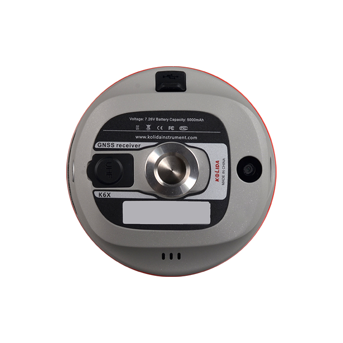
| Keypad1 physical buttons | Dimension105mm(φ)×58mm(H) | Weight540g (battery included) |
| Working Capability | ||
| Visual Stakeout with ARUses Dual-Camera to stakeout pts, lines, CAD | Visual Positioning (Optional)Shooting photo or video to measure coordinate | 3D Modeling (Optional)Process by Post-processing software |
RadioBuilt-in transmitting and receiving, 1/2 W | Tilt Survey Inertial Measurement | Electronic BubbleYes |
| Endurance 25h (static) 25h (rover mode, optimal condition) | OTG (Field Download) yes | |
| Satellite Tracking Ability | ||
Channels1698 channels | Constellation GPS, GLONASS, BEIDOU, GALILEO, QZSS, SBAS | L-BandGalileo HAS and BDS PPP |
| Positioning Output Rate1-20 HZ | Initialization Time2-8 s | |
| Positioning Precision | ||
UHF RTKHorizontal ±8mm +1 ppm | Network RTKHorizontal ±8mm +0.5 ppm Vertical ±15mm +0.5 ppm | |
| Static and Fast-Static Horizontal ±2.5mm +0.5 ppm | RTK Initial time 2-8s | |
| User Interaction | ||
Operation SystemLinux | Screen DisplayNot Available | wifiYes |
Voice GuideChinese/English/Korean/Spanish/Arabic/ Portuguese/Russian/Turkish/French/Italian | Data Storage16 GB internal, 64 GB external | Web UIYes |
| Keypad1 physical buttons | Dimension105mm(φ)×58mm(H) | Weight540g (battery included) |
| Working Capability | ||
| Visual Stakeout with ARUses Dual-Camera to stakeout pts, lines, CAD | Visual Positioning (Optional)Shooting photo or video to measure coordinate | 3D Modeling (Optional)Process by Post-processing software |
RadioBuilt-in transmitting and receiving, 1/2 W | Tilt Survey Inertial Measurement | Electronic BubbleYes |
| Endurance 25h (static) 25h (rover mode, optimal condition) | OTG (Field Download) yes | |
See more specs
2219
K6X 2507 EN.pdf
PDF [2.815MB] download
KOLIDA Instrument (KOLIDA) is a leading manufacturer of precision surveying equipment.
COMPANY PROFILE