2020-06-17
Lidar can accurately and quickly capture high-resolution and high density 3D point clouds, greatly improve the efficiency of surveying and mapping. It already becomes the choice of more and more professional surveyors. There are many brands and models of Lidar products on the market, how should users choose the appropriate Lidar according to their needs?
1. Choose a suitable carrier platform according your mission type

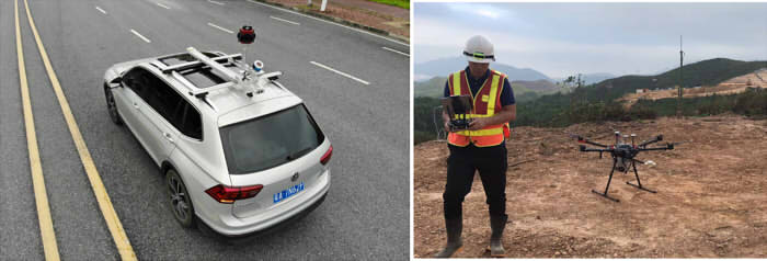
For Road Survey and other types of survey works which are accessible for cars, you can choose SUV based carrier platform.
For topographic survey, mine survey, forest survey, and most other surveying and mapping projects that are not easy for cars to pass, you should choose an aerial carrier platform.
According to the size of the measurement area, you can choose UAV or manned helicopter as carrier platform.
2. Choose Laser Scanner with suitable range, according to the terrain of your surveying area
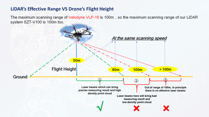
For most LIDAR with maximum working range of 100 meters, their effective working range is about 80m. They are designed for Road survey or Topographic survey in plains with relatively flat terrain, and are not suitable for working in mountainous or mining areas.
According to our experience, in order to get high precision data result within 80m scanning distance, the flight height shall be set to around 50m only.

For most LIDAR with maximum working range of 250 meters, their effective working range can be 200m. They are designed for most survey works in mountainous or mining areas with elevations of tens of meters to around one hundred meters.
For most LIDAR with maximum working range of 1000 meters, their effective working range can be 800m. They are designed for surveying an extra large area or surveying in big mountain which has variable elevation of hundreds of meters.
3. Decide whether to choose a Laser Scanner with stronger penetrating power according to the vegetation of mission area and data outcome requirement
The penetration performance of different laser scanners is different, the more echo signal it has, more laser beams can get through canopy.
Among all Laser Scanners, two are the most commonly used in Kolida Lidar system. One is Velodyne VLP-16, it emits laser beams one time and get two times echo signal back. Another is Riegl mini VUX-1, it emits laser beams one time and get five times echo signal back.
Laser Scanners with two echo signal back, including Velodyne VLP-16, is relatively cheaper. The laser beam can only get through forest canopy once, and the laser beam may not reach the ground finally.
In many areas, especially in Southeast Asia, there are dense canopy in the forest, and if laser beams can only get through canopy once, they can hardly reach the ground, thus we cannot get reliable DTM data.
The laser beam from Laser Scanners with five echo signal back, including Riegl mini VUX-1, can get through forest canopy four times, and has a better performance to measure the ground.
Video for reference: https://www.youtube.com/watch?v=EYbhNSUnIdU
4. Choose reliable product according to your mission accuracy requirement
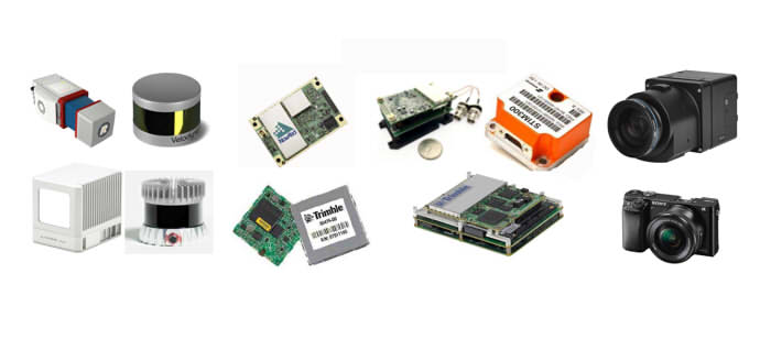
The key components of a Lidar system are Laser Scanner, Inertial measurement unit, GNSS, UAV and camera. The higher specifications the components have, the better accuracy of the Lidar system may achieve.
The Lidar consists of low capability and low quality components cannot realize steady performance and good measurement result in the real work.

5. Decide whether to choose a Laser Scanner that collects more points per second, according to the travelling speed of the vehicle
Generally speaking, if you can get more scanning points per square meter, the density of the point cloud would be higher, and measuring result would be better. SUV usually moves faster than UAV, thus requires laser scanner with faster Measuring Rate (more points per second).
If the scanning range is very high (hundreds of meters or over 1000m), you shall also choose laser scanner with faster Measuring Rate (more points per second).
6. Choose manufacturers who have better training capability
Compared with traditional survey equipment such as total stations and RTK, Lidar system is more complex and precise, with longer learning period, more difficult to handle, and the requirements for operation security is higher.
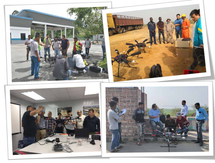
To buyers with less experience, it is better to choose suppliers and manufacturers who have rich experience of training, comprehensive training programs, and the ability to do training in the global market.

A Case Study:
A surveying company in Southeast Asia, recently asked Kolida to quote a set of Lidar. The mission requirement is to carry out mine survey with 5-10 cm accuracy. The mission area is in the tropical rainforest zone, mountainous and with up to 100 meters elevation change. The data result they need includes DTM.
According to his project requirement, we recommended KOLIDA Z-Lab R250 LIDAR solutions with DJI M600 Pro carrier platform.
Why?
1) The laser scanner is RIEGL mini VUX-1, with 250m scanning range, and has 5 echo signals. Its laser beams can get through canopy 4 times. So in rainforest area with dense plants, there will still be a lot of laser beams to reach the ground, so that we can get accurate DTM data.
2) The GNSS Positioning module is NovAtel OEM-615 (sister company of Leica, part of Hexagon group). The Inertial Measurement Unit (IMU) is also from Novatel, model STIM-300.
3) The UAV carrier platform is DJI Matrice 600 Pro, which is the most reliable multi-rotor for aerial survey for now. After carrying KOLIDA Z-Lab R250 Lidar, its effective flight height can be 200m, which is suitable for most of Topographic Survey project and Mine Survey project with elevations of tens of meters to more than one hundred meters.
In the Lidar Survey works we did before, in many cases KOLIDA Z-Lab R250 Lidar could realize 5cm accuracy. This accuracy was proved by comparing the Lidar data with GNSS RTK data result.