

2cm/ 60° Tilt Survey Technology |  | All Constellation Signal Tracking | | | New System Structure |
kFill, Save RTK Correction Signal Loss Kolida's kFill technology is able to provide a 5-minutes sustainable high accuracy service during a temporary RTK or VRS signal coverage outtages. After the correction data signal recovers, receiver will switch to real time correction data connection seamlessly. |
|
 | The Best-in-Class GNSS Engine The integrated advanced 1598-channel GNSS technology helps K3IMU to collect signal from GPS, Glonass, Beidou, Galileo, QZSS, in particular the latest BeiDou III. It greatly improved the data quality and satellite signal capturing speed of GNSS surveying. Video: https://www.youtube.com/watch?v=BIEyktshIgk |
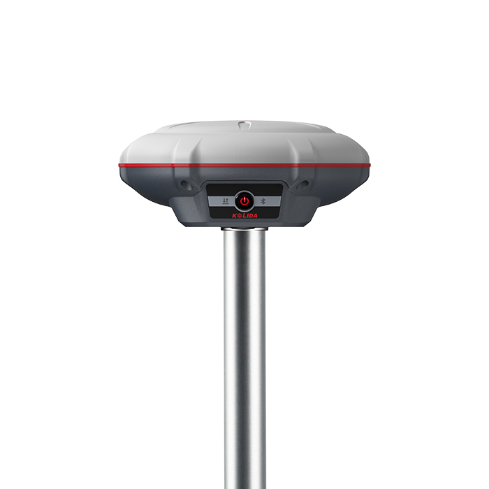
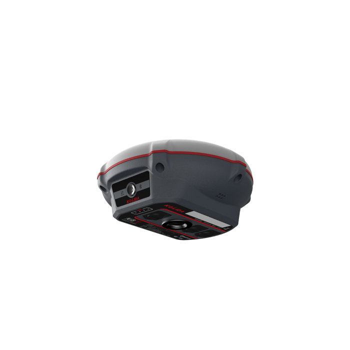
"SOC" , New System Structure "SOC" means“System-on-Chip”, this new design integrates several individual hardware modules into one microchip. The receiver can be much lighter and smaller, system runs more stable and faster, bluetooth connection speed is faster. The“High-Low Frequency Integration”antenna can effectively restrain the interruptive signal. |  |
 | Constantly Ungraded Inertial Measurement KOLIDA’s 3rd generation inertial sensor and algorithm are onboard now. The working speed and stability have been improved for 30% from the last version. When the GNSS fixed solution is lost and recovered again, Inertial sensor can remain the working status in a few seconds, no need to spend time to reactivate it... Tilt angle is up to 60 degrees, accuracy is down to 2cm. |
0.69 kg, Comfort Experience K3 IMU is ultra light, the total weight is only 0.69 kg including battery, 40% even 50% lighter than a traditional GNSS receiver. The light-weight design reduces surveyor’s fatigue, increase their mobility, is especially helpful to work in challenging environment. |  |
 | A Huge Leap In Working Hours Thanks to the high-capacity battery and the intelligent power management plan, K3 IMU can work up to 12 hours in RTK radio rover mode, up to 15 hours in static mode. The charging port is Type-C USB, users can choose KOLIDA quick charger or their own smartphone charger or power bank to recharge. Video: https://www.youtube.com/watch?v=ckQNU4MS4uQ |
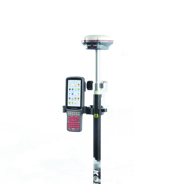
Easy Operation K3 IMU can seamlessly connect to RTK GNSS networks via Android controller or smartphone with KOLIDA field data collection software, to work as a network rover, also can be worked as UHF radio rover by using its internal radio modem.. |  |
| New Radio, Farlink Tech. Farlink technology is developed to send large number of data and avoid data loss. This new protocol improves the signal-catching sensitivity from -110db to -117db, so K3IMU can catch the very weak signal from a base station far way. |
Practical Functions K3 IMU employs Linux system, it helps surveyors to accomplish their missions easier, faster and more accurate by delivering exceptional quality and innovative features. |  |
|
|
New app. New Productivity Windows CE data controller is too old technology? No problem. Simply use Ksurvey, Field Genius Android, SurvX App on your smart phone or tablet. Enjoy the smooth operation of Android platform ! | Post-processing Sw. Free of Charge KOLIDA GEO Office integrates static data processing & Kinematic data adjustment |
| Satellite Tracking Ability | ||
Channels1598 channels | Constellation GPS, GLONASS, BEIDOU, GALILEO, QZSS, SBAS | MMS L-BandReserved |
| Positioning Output Rate1-20 HZ | Initialization Time2-8 s | |
| Positioning Precision | ||
UHF RTKHorizontal ±8mm +1 ppm | Network RTKHorizontal ±8mm +0.5 ppm Vertical ±15mm +0.5 ppm | |
| Static and Fast-Static Horizontal ±2.5mm +0.5 ppm | RTK Initial time 2-8s | |
| User Interaction | ||
Operation SystemLinux, System-On-Chip | Screen DisplayNo | wifiYes |
Voice Guideyes, 8 language | Data Storage4 GB internal, 32GB external | Web UIYes |
| Keypad1 physical buttons | ||
| Working Capability | ||
RadioBuilt-in receiving | Tilt Survey Inertial Measurement | Electronic BubbleYes |
| Endurance up to 15 hours (static mode), up to 12 hours (internal UHF rover mode) | OTG (Field Download) yes | kFill yes |
See more specs
9919
K3 imu EN 2024.pdf
PDF [1.55MB] download
KOLIDA Instrument (KOLIDA) is a leading manufacturer of precision surveying equipment.
COMPANY PROFILE


