
2cm/ 60° Tilt Survey Technology |  | All Constellation Signal Tracking | | | 10 New Programs |
 | More Advanced GNSS Algorithm Empowered by the Polestar Algorithm, V1 can track enormous signals of all constellations with stunningly fast fixing speed even under the thick cover of trees or beside tall buildings. Coordinates will be examined twice to ensure the utmost accuracy. |
Live-view & AR for Stakeout V1 allows you to implement immersive AR stakeout in any working environment. It is suitable for both non-experienced surveyor and expert to follow the visual guide to find the targets with data controller camera (for direction) and the 2MP camera on receiver (for precise positioning), provides up to 50% more efficiency. |  |
 | User-friendly Design V1 enable user to create an Ultra Fast Connection between Controller and Receiver. There is a function "Radio Signal Strength Check” to compare signal quality of each radio channel and choose the most suitable one before working. The feature "Multiple Protocols Compatibility”is to support SATEL and other mainstream radio protocols. |
One of the Best IMU in Industry Traditionally, surveyors encountered issues with IMU usability when rotating the pole during changing walking direction or adjusting the receiver attitude. V1 IMU effectively eliminates the loss of IMU status in most scenarios, enhancing IMU availability and productivity. During AR stakeout, you can walk at your own pace without worrying about losing IMU, making workflow smooth. |  |
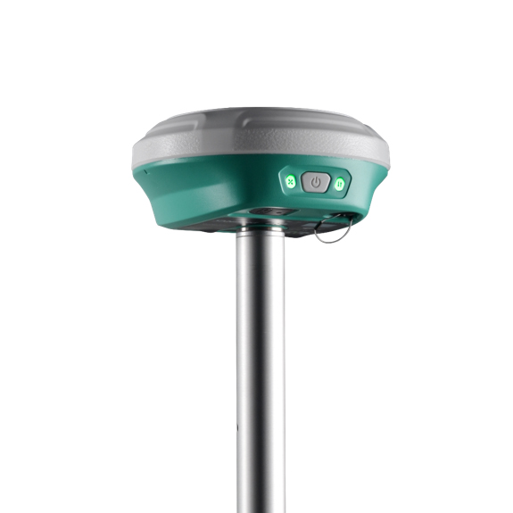
 | Portable and Rugged V1 represents an ultra-light GNSS receiver surpassing its competitors. Weighing a mere 0.668 kg, inclusive of the battery, it stands as much as 40% to 50% lighter than conventional GNSS receivers. This lightweight construction alleviates surveyors' fatigue while enhancing their maneuverability, making it particularly advantageous for operations in demanding environments. V1 features IP 68 proof level. |
Software in Packge When surveyors need to do post-processing of GNSS data, our software Kolida Geo Office always can provide state-of-the-art technology to help you to produce optimal results. User just need to import field data, the software will automatically process GNSS baselines. Once results come out, the software can generate reports. (Kolida Geo Office also can process photogrammetry Image Data) |  |
| Satellite Tracking Ability | ||
Channels1808 | ConstellationGPS, GLONASS, BEIDOU, GALILEO, SBAS, QZSS | MSS L-BandB2b ppp for Asian-Pacific Area |
| Positioning Output Rate1Hz-20Hz | Initialization Time<10s | |
| Positioning Precision | ||
UHF RTKHorizontal ±8mm + 1 ppmVertical ±15mm + 1ppm | Network RTKHorizontal ±8mm + 0.5ppmVertical ±15mm+0.5ppm | RTXHorizontal N/AVertical N/A |
| Static and Fast Static Horizontal ±2.5mm + 0.5ppmVertical ±5mm + 0.5ppm | RTK Initialization Time 2-8s | |
| User Interaction | ||
Operation SystemLinux | Screen DisplayN/A | WifiYes |
| Voice Guide Yes | Data Storage 8GB internal; | Web UIYes |
| Working Capability | ||
Built-in RadioEmitting and receiving. Typical working range 7-8km, in good environment 10-12km. | Tilt Survey Inertial Measurement | Electronic BubbleYes |
| Endurance up to 30 hours (static mode), >7 hours (internal UHF base mode), up to 23 hours (rover mode) | OTG Function (Field Download) yes | Other Function ... |
See more specs
12300
V1 Data Sheet 202406 Kolida.pdf
PDF [1.262MB] download
KOLIDA Instrument (KOLIDA) is a leading manufacturer of precision surveying equipment.
COMPANY PROFILE