
2cm/ 60° Tilt Survey Technology |  | All Constellation Signal Tracking | | | 10 New Programs |
 | More Advanced GNSS Engine Featuring a powerful 692-channels GNSS mainboard inside, K20s can track and process all the existed satellite constellations. With the utility of BEIDOU (COMPASS) signal, the data acquisition speed and GNSS signal stability are greatly improved from old generation technology. |
10 Innovations to Increase Efficiency More than 10 programs or functions were re-designed to make your work flow simpler and smoother, let you to work easier and comfortable, help you to get more reliable working result. Search "K20s" on youtube.com to discover it. |  |
 | More Durable and Rugged K20s is fully sealed, has a IP 68 level proof. The built-in battery has 10,000 mAh capacity and can work 8 to 14 hours as RTK rover, with only one recharge. |
Work Safer and Easier Thanks to the inertial measurement technology, K20s allows user to do a tilt survey with a maximum tilt angle of 60 °. Centering is not a must, so surveyors can stay in safe position when they measure on motorway, and don't need to step into water . |  |
 | Fast and accurate Not like tilt sensor, Inertial Measurement Unit is no more affected by the earth's magnetic field and requires no correction. It can be activated and start working within only few seconds, this fast positioning will increase measurement speed by over 30%. The combination algorithm of IMU + GNSS can get fixed solution faster and keep measurement results more stable, accuracy is down to 2cm. Video: https://www.youtube.com/watch?v=BK4v0KHTmNc |
Measure where others can't Corner of wall? Points underneath pipe? Points occupied by car? These targets are no more accessible.. |  |
|
|
New app. New Productivity Windows CE data controller is too old technology? No problem. Simply download SurvX App on your smart phone or tablet. Enjoy the smooth operation of Android platform ! | Post-processing Sw. Free of Charge KOLIDA GEO Office integrates static data processing & Kinematic data adjustment |
Video Demonstration: https://www.linkedin.com/pulse/2020-new-model-k1-k20s-series-increase-your-efficiency-andy-lau/ | |
| Satellite Tracking Ability | ||
Channels692 | ConstellationGPS, GLONASS, BEIDOU, GALILEO, SBAS, QZSS | MSS L-BandFunction preserved |
| Positioning Output Rate1Hz-50Hz | Initialization Time<10s | |
| Positioning Precision | ||
Static and Fast Static Horizontal ±2.5mm + 0.5ppmVertical ±5mm + 0.5ppm | Network RTKHorizontal ±8mm + 0.5ppmVertical ±15mm+0.5ppm | RTK Initialization Time 2-8s |
| User Interaction | ||
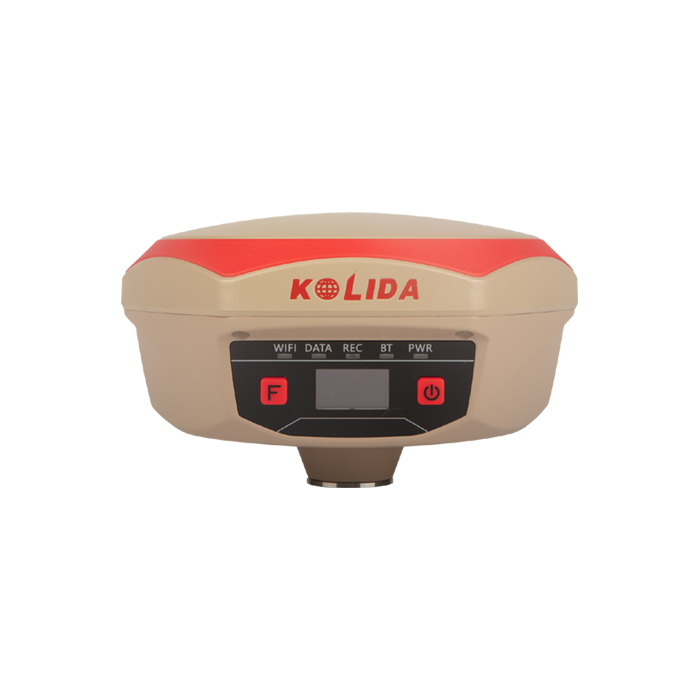
Operation SystemLinux | Screen Display1 inch OLED | WifiYes |
| Voice Guide Yes | Data Storage 8GB internal; up to 32GB external. | Web UIYes |
| Working Capability | ||
Built-in RadioNot-Available | Tilt Survey Inertial Measurement | Electronic BubbleYes |
| Endurance >14 hours (static mode), >7 hours (internal UHF base mode), 8 to14 hours (rover mode) | OTG Function (Field Download) yes | Other Function Mobile Reference Station, Repeater, Router |
| Satellite Tracking Ability | ||
Channels692 | ConstellationGPS, GLONASS, BEIDOU, GALILEO, SBAS, QZSS | MSS L-BandFunction preserved |
| Positioning Output Rate1Hz-50Hz | Initialization Time<10s | |
| Positioning Precision | ||
Static and Fast Static Horizontal ±2.5mm + 0.5ppmVertical ±5mm + 0.5ppm | Network RTKHorizontal ±8mm + 0.5ppmVertical ±15mm+0.5ppm | RTK Initialization Time 2-8s |
| User Interaction | ||
Operation SystemLinux | Screen Display1 inch OLED | WifiYes |
| Voice Guide Yes | Data Storage 8GB internal; up to 32GB external. | Web UIYes |
| Working Capability | ||
Built-in RadioNot-Available | Tilt Survey Inertial Measurement | Electronic BubbleYes |
| Endurance >14 hours (static mode), >7 hours (internal UHF base mode), 8 to14 hours (rover mode) | OTG Function (Field Download) yes | Other Function Mobile Reference Station, Repeater, Router |
See more specs
1278
K20s RTK GNSS Net.pdf
PDF [640.804KB] download
KOLIDA Instrument (KOLIDA) is a leading manufacturer of precision surveying equipment.
COMPANY PROFILE
