
2cm/ 60° Tilt Survey Technology |  | All Constellation Signal Tracking | | | Robustness |
 | The World Leading GNSS Engine The Maxwell 7 GNSS engine inside K30 PRO provides an ultra-fast positioning speed, typically it starts tracking satellite signal within 5 seconds after turning on, coordinate can be acquired within 10 seconds. |
Star-Fill, Save the Signal Loss This unique function will let you to continue working a few minutes when radio or mobile signal is becoming very poor or even lose in blind area. The accuracy is down to 2cm. See the exaple video (K1 Pro) from https://youtu.be/VvHJN6bkUDo |  |
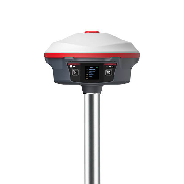
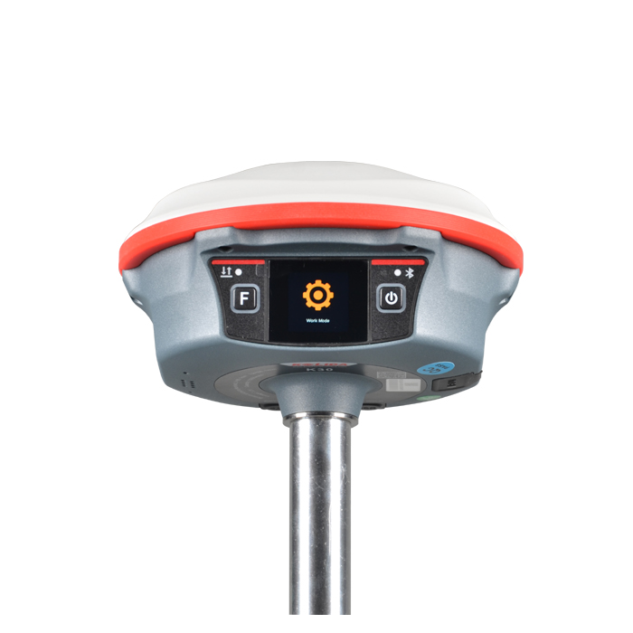
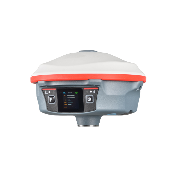
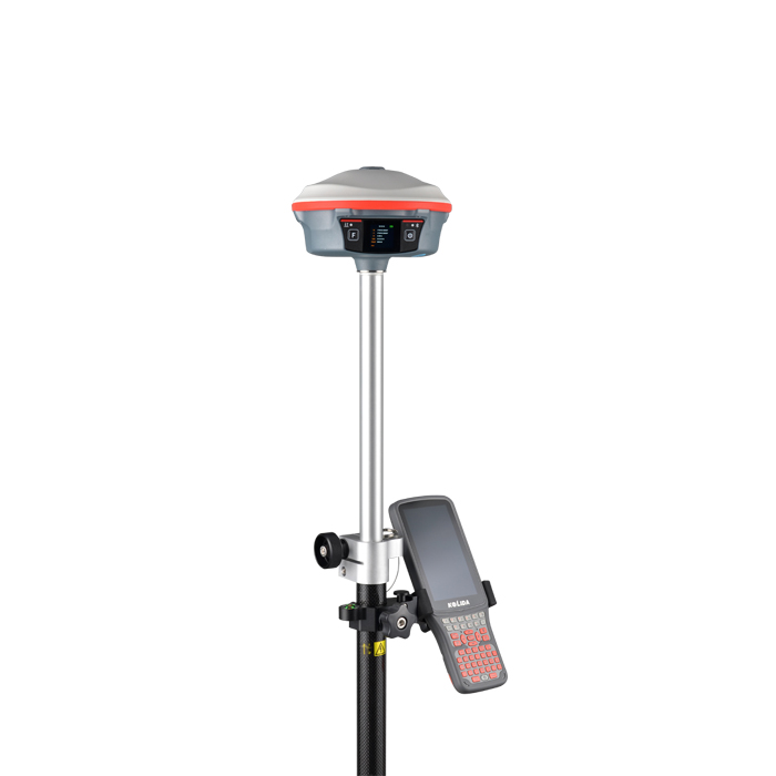
 | More Freedom to Operate By using the touch screen on K30 Pro, users are able to operate GNSS receiver like their smart phone. Using both of touch screen and key buttons will make your workflow easier and faster. |
New Radio, Farlink Tech. Farlink technology is developed to send large number of data and avoid data loss. This new protocol improves the signal-catching sensitivity from -110db to -117db, so K30 can transmit to 10 km away by only 1 watt power consumption and to 15 km away by 3 watt power (in optimal environment condition). |  |
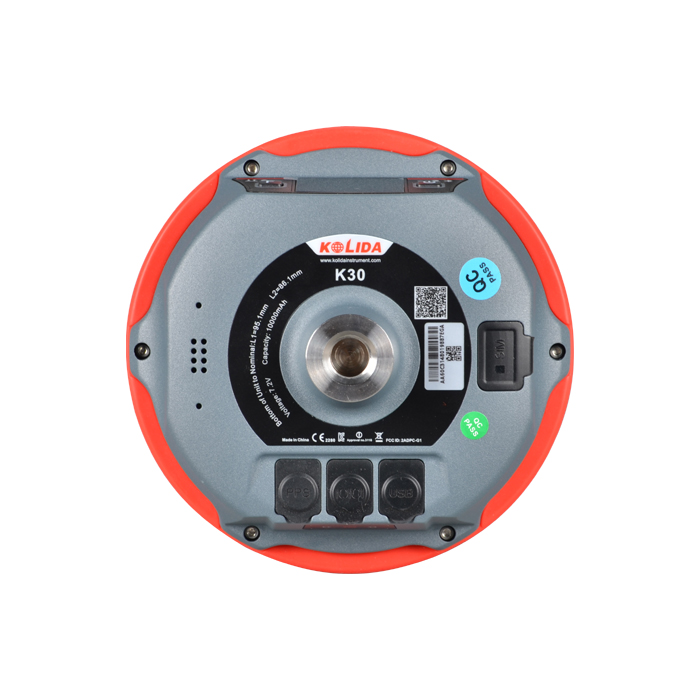
 | Working Longer, Stop Less. Thanks to the low consumption operation system design, K30 Pro can work up to 10 hours in RTK base mode and up to 25 hours in rover mode, up to 27 hours in static mode. (Environment temperature is 25℃) K30 Pro can be recharged by Type-C USB connector. |
Constantly Upgraded Inertial Measurement KOLIDA’s 3rd generation inertial sensor and algorithm are onboard now. The working speed and stability have been improved for 30% from the last version. When the GNSS fixed solution is lost and recovered again, Inertial sensor can remain the working status in a few seconds, no need to spend time to reactivate it... Tilt angle is up to 60 degrees, accuracy is down to 2-3cm (when tilt angle is within 30°), 5cm (tilt angle within 60°) |  |
|
|
New app. New Productivity Windows CE data controller is too old technology? No problem. Simply use Ksurvey, Field Genius Android, SurvX App on your smart phone or tablet. Enjoy the smooth operation of Android platform ! | Post-processing Sw. Free of Charge 2022 version KOLIDA GEO Office integrates static data processing & Kinematic data adjustment (Long baseline processing function is optional) |
| Satellite Tracking Ability | ||
Channels336 channels | Constellation GPS, GLONASS, BEIDOU, GALILEO, QZSS, SBAS | L-BandStarlink and StarFill |
| Positioning Output Rate1-50 HZ | Initialization Time2-8 s | |
| Positioning Precision | ||
UHF RTKHorizontal ±8mm +1 ppm | Network RTKHorizontal ±8mm +0.5 ppm Vertical ±15mm +0.5 ppm | |
| Static and Fast-Static Horizontal ±2.5mm +0.5 ppm | RTK Initial time 2-8s | |
| User Interaction | ||
Operation SystemLinux | Screen Display1.3 inches color touch screen | wifiYes |
Voice Guideyes, 8 language | Data Storage16 GB internal, 64 GB external | Web UIYes |
| Keypad2 physical buttons | ||
| Working Capability | ||
RadioBuilt-in transmitting and receiving, 1/2/3 W | Tilt Survey Inertial Measurement | Electronic BubbleYes |
| Endurance up to 25-30 hours (static mode), up to 20-27 hours (rover mode), up to 10 -14 hours (base mode) | OTG (Field Download) yes | |
See more specs
9688
K30 Pro EN.pdf
PDF [4.89MB] download
KOLIDA Instrument (KOLIDA) is a leading manufacturer of precision surveying equipment.
COMPANY PROFILE


