


K60 Max Pro
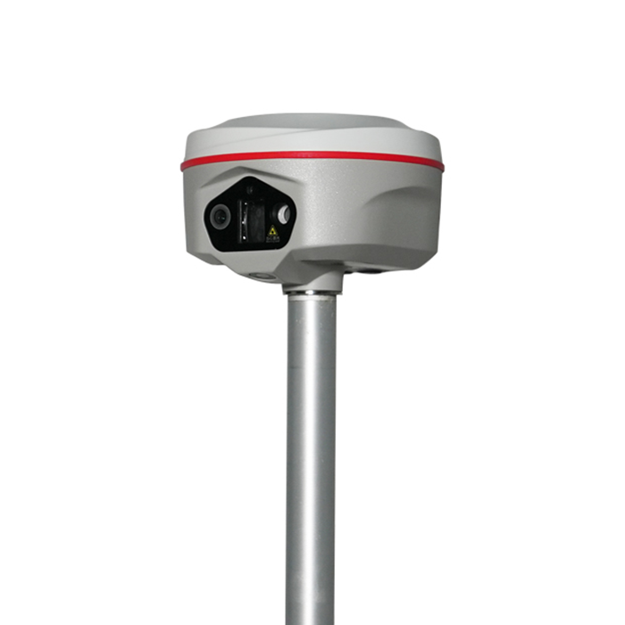
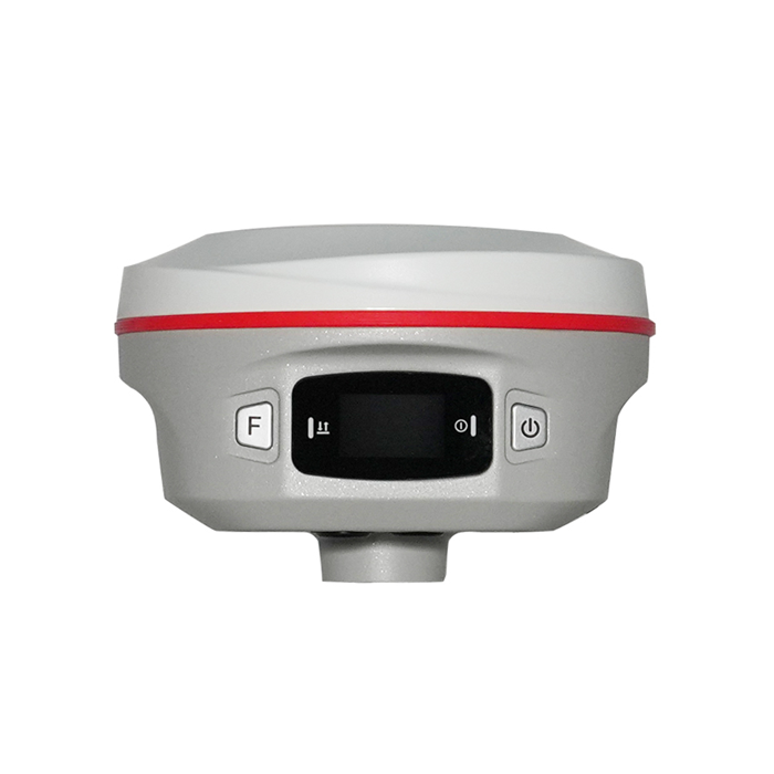
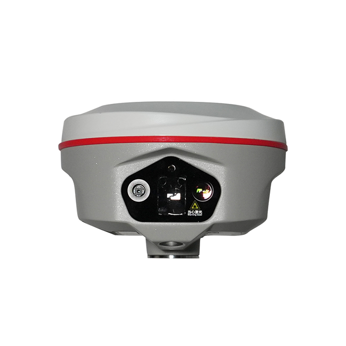
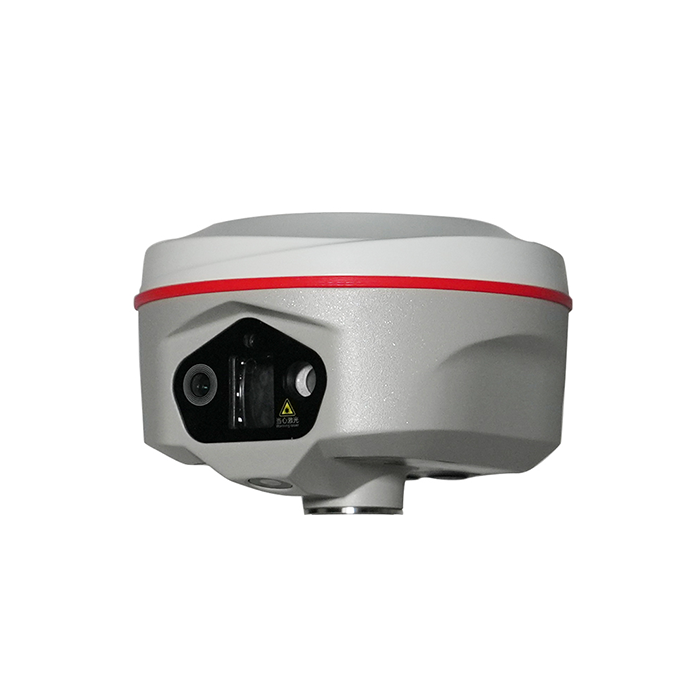

150m (standard) and up to 200m (optimal conditions) |  | 400 Hz / 0.05°/ 0.15° easy & smooth workflow | | | Video Shooting Photogrammetry Positioning |
Rapid Multi-Target Capture Without Limits Driven by a 520nm green laser operating at a high-speed 5Hz rate to instantly adapt to different surface reflectivities, the system effortlessly locks onto leaves, metal, or glass in real-time. This exceptional adaptability ensures any material is instantly captured, eliminating measurement failures on difficult or reflective surfaces. | |
The 6th Gen. IMU instant activation, rock-solid accuracy Thanks to the high-frequency 400 Hz IMU, Just take a natural step, the IMU is ready instantly, and with the 0.15° heading accuracy caps 20-meter deviations under 5cm to stop coordinate drifting and ensure rock-solid data . It also delivers ultra-stable performance, walk at your pace without worrying about losing IMU. | |
Triple HD Camera seamless lens switch, Clear laser targeting The 8MP main camera with 72-degree view for quick close target locking. When zooming in, it auto-switches to the 25mm telephoto lens for precise long-range aiming without manual adjustment. Meanwhile, it keeps the laser point clear, and together with the 5Hz laser module, it ensures the screen crosshair perfectly matches the point. | |
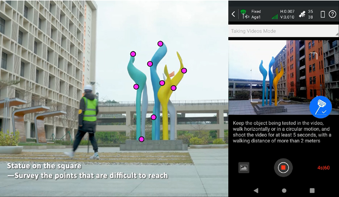
Mass Data Collection, By Video Shooting. With Kolida's advanced photogrammetry technology, K60 Max Pro user can easily acquiring coordinates for hundreds of points within minutes, by using the 8MP front camera to shoot a video or some photos. See the example video from https://www.youtube.com/watch?v=8l6vsK7eL7A |
|
 | 3D Modeling, The New Value Added Surveyors can use K60 Max Pro to capture photoes of the objectives and process out 3D model. The data output can be used with the 3rd party designing software, also can be combined with Drone (UAV) data, such as DJI and other brands. |
| Satellite Tracking Ability | ||
Channels1698 channels (1808 is optional ) | Constellation GPS, GLONASS, BEIDOU, GALILEO, QZSS, SBAS | L-BandBDS PPP & Galileo HAS |
| Positioning Output Rate1-20 HZ | Initialization Time<10 s | |
| Positioning Precision | ||
UHF RTKHorizontal ±8mm +1 ppm | Network RTKHorizontal ±8mm +0.5 ppm Vertical ±15mm +0.5 ppm | |
| Static and Fast-Static Horizontal ±2.5mm +0.5 ppm | RTK Initial time 2-8s | |
| User Interaction | ||
Operation SystemLinux | Screen Display1.14’ LED, 135*240 pixel | wifiYes |
Voice Guideyes, 9 language | Data Storage16 GB internal, Support external USB storage (OTG) | Web UIYes |
| Keypad2 physical buttons | ||
| Working Capability | ||
| Laser 3R green laser, 150m range (200m in optimal condition) | Camera Video shooting camera: 8MP Laser aiding telephoto camera: 8MP AR stakeout camera: 2MP | IMU calibration-free, up to 120°, refresh rate 400 Hz, pitch & roll accuracy 0.05 °,heading accuracy 0.15° |
| Laser MeasurementShooting Laser to measure coordinate & stakeout | Visual PositioningShooting photo or video to measure coordinate | 3D ModelingProcess by Post-processing software |
Visual Stakeout with ARUses Dual-Camera to stakeout pts, lines, CAD | RadioBuilt-in transmitting and receiving, 1/2 W | Tilt Survey Inertial Measurement |
| Endurance up to 16 hours (static mode), up to 12 hours (rover mode), up to 10 hours (UHF base mode) | OTG (Field Download) yes | Electronic Bubble Yes |
| Satellite Tracking Ability | ||
Channels1698 channels (1808 is optional ) | Constellation GPS, GLONASS, BEIDOU, GALILEO, QZSS, SBAS | L-BandBDS PPP & Galileo HAS |
| Positioning Output Rate1-20 HZ | Initialization Time<10 s | |
| Positioning Precision | ||
UHF RTKHorizontal ±8mm +1 ppm | Network RTKHorizontal ±8mm +0.5 ppm Vertical ±15mm +0.5 ppm | |
| Static and Fast-Static Horizontal ±2.5mm +0.5 ppm | RTK Initial time 2-8s | |
| User Interaction | ||
Operation SystemLinux | Screen Display1.14’ LED, 135*240 pixel | wifiYes |
Voice Guideyes, 9 language | Data Storage16 GB internal, Support external USB storage (OTG) | Web UIYes |
| Keypad2 physical buttons | ||
| Working Capability | ||
| Laser 3R green laser, 150m range (200m in optimal condition) | Camera Video shooting camera: 8MP Laser aiding telephoto camera: 8MP AR stakeout camera: 2MP | IMU calibration-free, up to 120°, refresh rate 400 Hz, pitch & roll accuracy 0.05 °,heading accuracy 0.15° |
| Laser MeasurementShooting Laser to measure coordinate & stakeout | Visual PositioningShooting photo or video to measure coordinate | 3D ModelingProcess by Post-processing software |
Visual Stakeout with ARUses Dual-Camera to stakeout pts, lines, CAD | RadioBuilt-in transmitting and receiving, 1/2 W | Tilt Survey Inertial Measurement |
| Endurance up to 16 hours (static mode), up to 12 hours (rover mode), up to 10 hours (UHF base mode) | OTG (Field Download) yes | Electronic Bubble Yes |
See more specs
50

KOLIDA Instrument (KOLIDA) is a leading manufacturer of precision surveying equipment.
COMPANY PROFILE