
SkyLines PPK Aeropos Software
 | to learn the operation | | | Supported |
 | The Advantage of Skylines Software By using this powerful tool, drone users can obtain highly accurate POS (Positioning & Orientation System) data at centimeter level via post processing and may be independent of ground control points for further adjustment in aerial triangulation. |
Why do We Work PPK? In difficult working environment, sometimes radio or mobile signal is very weak or even interrupted, then drones will be unable to obtain RTK fixed solution. When using PPK method, base station and rover device individually store GNSS data, post processe it after the survey has been completed. It ensures the quality of measurement result, the precision is down to few centimeters. |  |
 | Main Features • GNSS, GLONASS, BEIDOU, GALILEO supported • Both WGS84 and local coordinate system are supported • Applicable for DJI Phantom4RTK or other drone equipped with RTK/PPK module • Applicable for Kolida GNSS and other brands GNSS receivers. • Allows to import maximum 10 hours observation data in 5Hz. • Supports processing multi-flights data. • POS result file can be directly applied to various types of aerial photogrammetry data processing software, such as Pix4D, Skyphoto... |
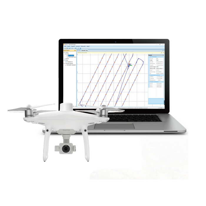
Practical Functions, Easy Operation Intuitive interfaces and optimized algorithm help surveyors to do a fast processingand to deliver a quality working result. Click the pic on the right to play video demo. Or search Kolida Skyline on youtube.com, and contact Kolida team to get trial code for free. |  |
GNSS System SupportedGPS, GLONASS, BEIDOU, GALILEO | AccuracyHorizontal: down to ±1cm + 1ppmVertical: down to ±1cm + 1ppm | Input Format.TXT |
| OS Windows 7 or above | Ram 4GB | GPU not required |
GNSS System SupportedGPS, GLONASS, BEIDOU, GALILEO | AccuracyHorizontal: down to ±1cm + 1ppmVertical: down to ±1cm + 1ppm | Input Format.TXT |
| OS Windows 7 or above | Ram 4GB | GPU not required |
See more specs
6225
Kolida Skyline 20200408.pdf
PDF [495.207KB] download1.6.210410.SkyLines(English).rar
RAR [17.562MB] download
KOLIDA Instrument (KOLIDA) is a leading manufacturer of precision surveying equipment.
COMPANY PROFILE